Victorian Goldfields
The Central Victorian Goldfields host world-class gold-antimony deposits, including the Fosterville mine, Costerfield mine and Sunday Creek discovery.
Kalamazoo’s Victorian portfolio is one of the largest tenement holdings in the Central Victorian Goldfields, comprising 2,006km² covering the Bendigo Zone, which has historically produced more than 60Moz of gold, and the Melbourne Zone, which demonstrates high-grade gold-antimony potential.
Mt Piper Gold Project
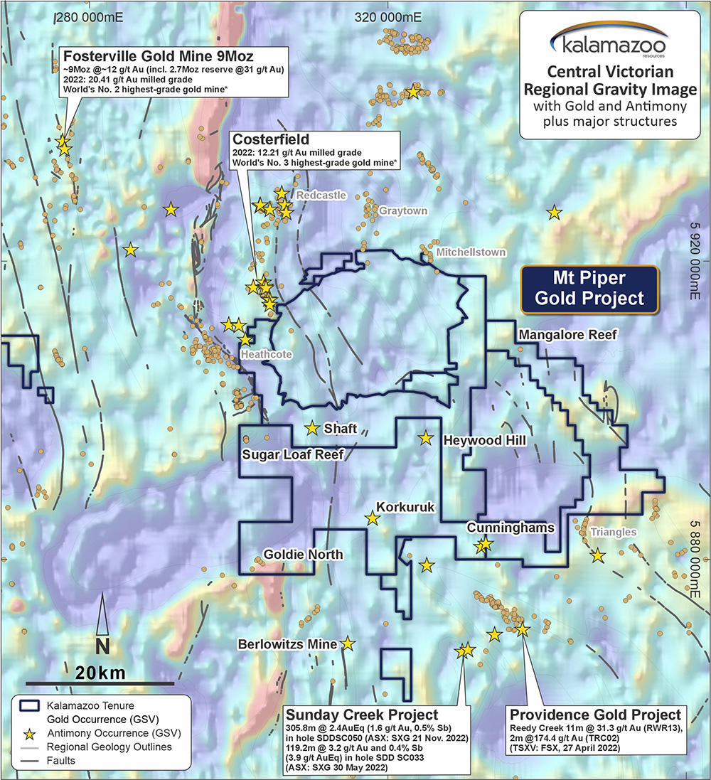
The Mt Piper Gold Project covers 1,522km² ~75km north of Melbourne and is traversed by the Hume Freeway, boasting excellent access to local infrastructure.
The Mt Piper Gold Project is adjacent to Agnico Eagle Mine Limited’s (NYSE: AEM) large exploration land tenure and 30km from its world-class 9Moz Fosterville gold mine, with Costerfield Gold-Antimony Mine to the north and the Sunday Creek Gold-antimony discovery to the south. In 2022, Fosterville (20.4g/t Au) and Costerfield (12.2g/t Au) were the world’s 2nd and 3rd highest-grade gold mines (S&P Market Intelligence 13 December 2022).
The Mt Piper Gold Project is considered highly prospective for Fosterville-style epizonal, high-grade gold and antimony deposits. All tenements are considered under-explored, limited to very shallow drilling and not subjected to modern exploration techniques.
South Muckleford Gold Project
The South Muckleford Gold Project is located in the Maldon Goldfield, only 10km west of Kalamazoo’s 100%-owned Castlemaine Gold Project.
South Muckleford covers the highly prospective regional Muckleford Fault and adjacent historical workings to the west (i.e. hanging-wall position), as well as the southern strike extent of the Union Hill Gold Mine.
Kalamazoo is reviewing its previous discovery of a broad epizonal gold-antimony mineralised system within the project, analogous to that observed at the Fosterville and Costerfield mines
The Maldon Goldfield is the 7th largest Victorian goldfield with historical production of >1,975,000oz (>56t) and 317,000oz (9t) of primary and alluvial gold, respectively*.
*Phillips, G.N., 2010 Victorian Gold Province, Australia: a contemporary exploration guide. GeoScience Victoria Special Publication.
Castlemaine Gold Project
The Castlemaine Gold Project is located in a supportive and increasingly active mining region, with exploration and development success across multiple projects, including Fosterville, Tandarra and Costerfield.
The Castlemaine Gold Project comprises two exploration tenements, EL006679 (“Wattle Gully”, ~70km2) and EL006752 (“Wattle Gully South”, ~218km2).
EL6679 lies immediately east and south of the Castlemaine township, covering almost the entire historic Castlemaine Goldfield. EL6752 lies to the east and south of EL6679, covering regional geological structures known to be associated with gold potential.